Real screenshots of the application, organized by module.
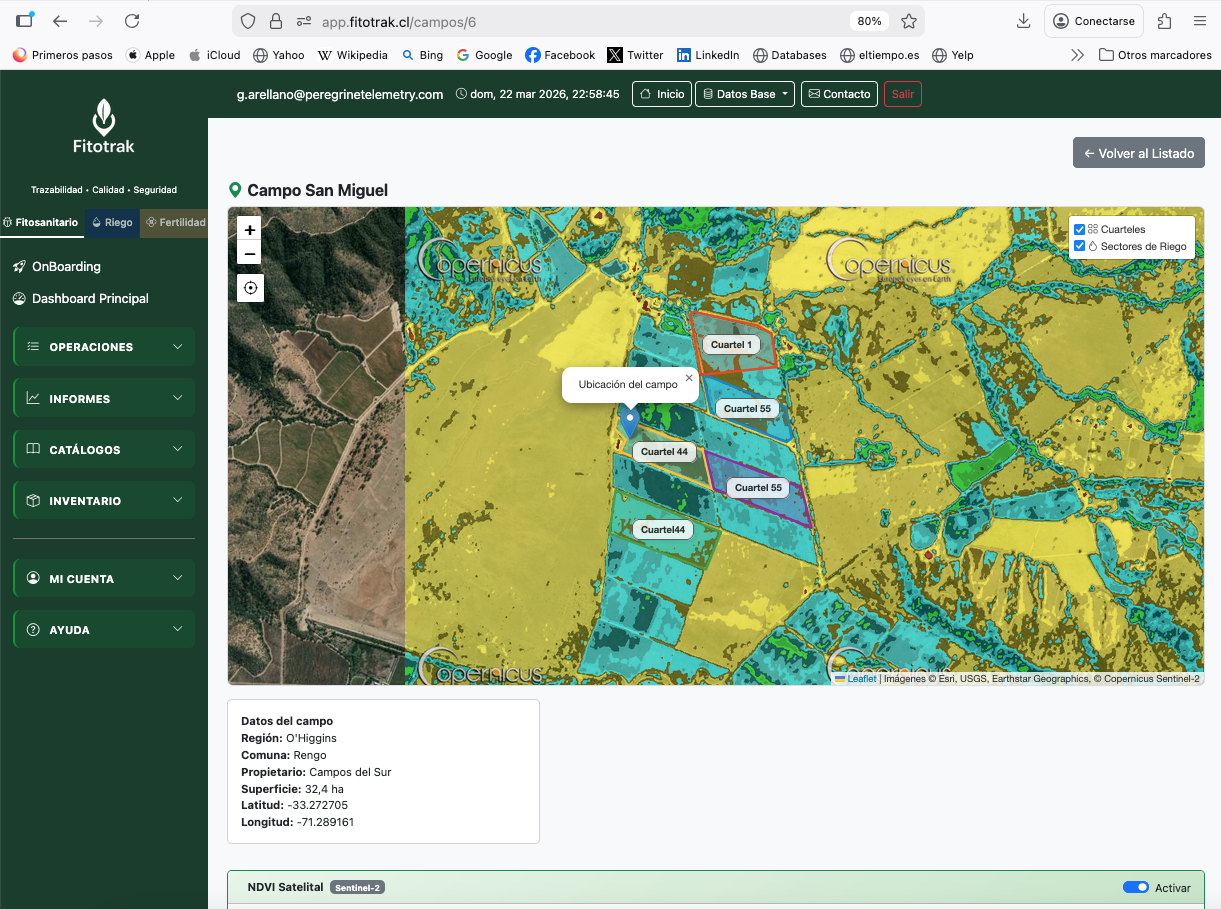
The geographic foundation used by all modules
Team and permissions shared across modules
Machinery, suppliers, and landowners
Draw your blocks directly on the map and calculate areas automatically
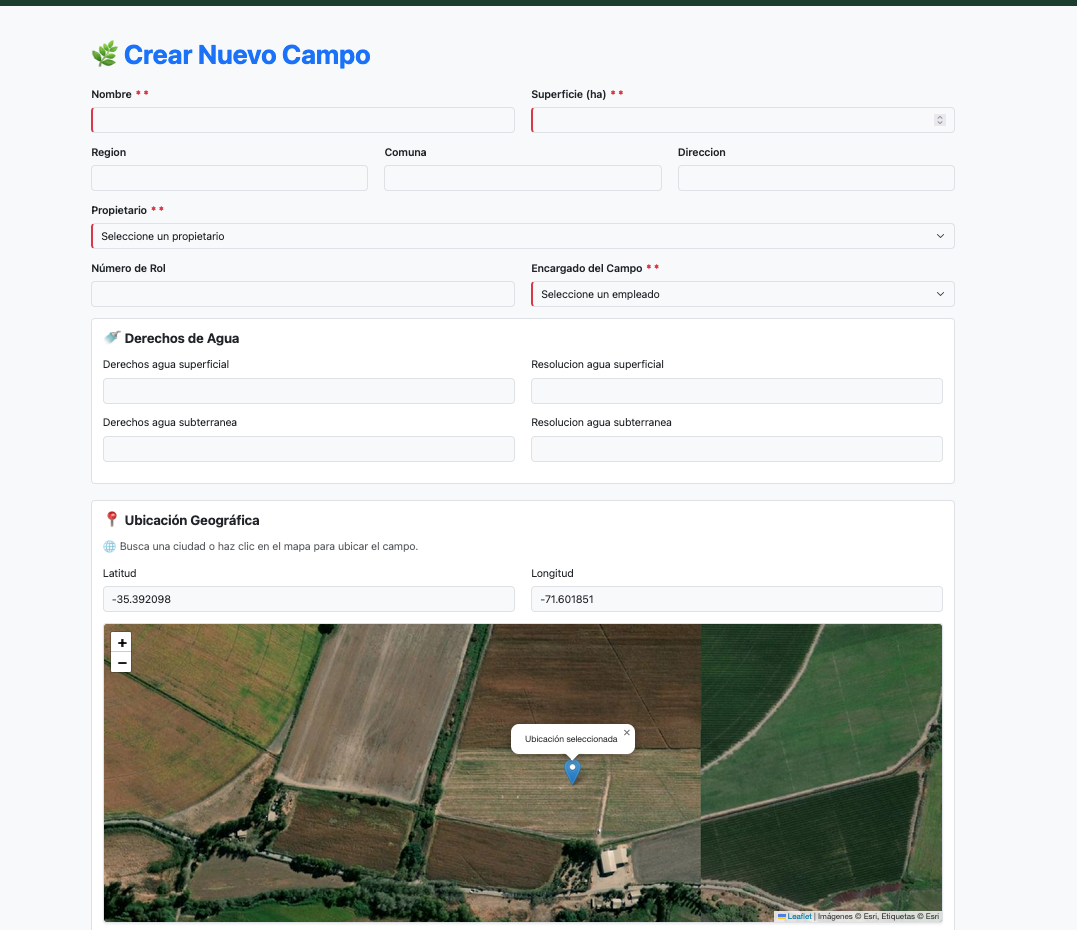
Create new field
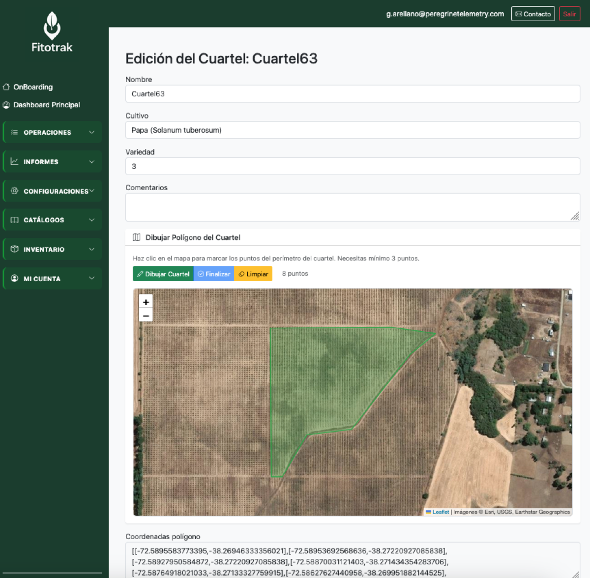
Draw blocks on map
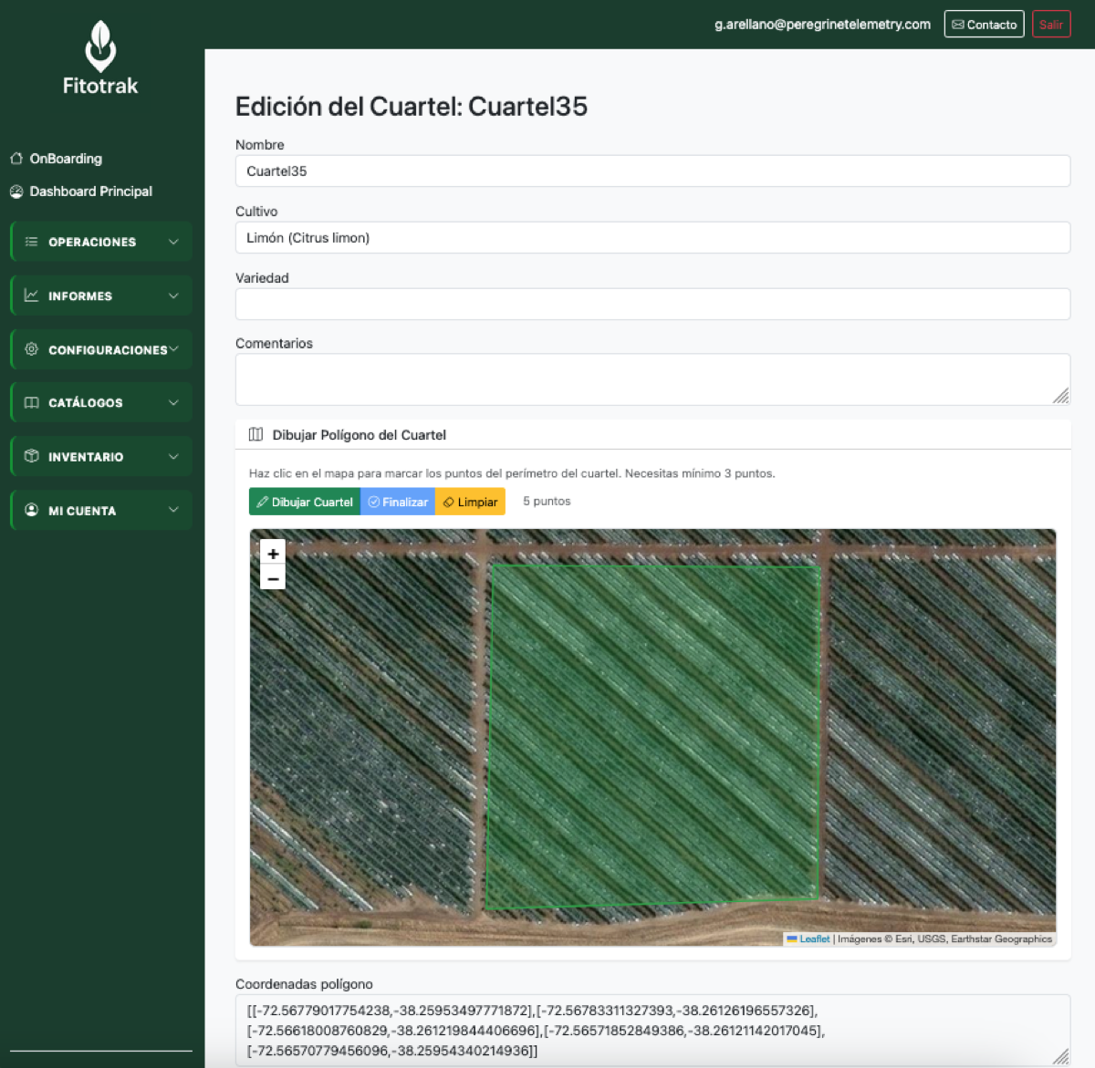
Block detail
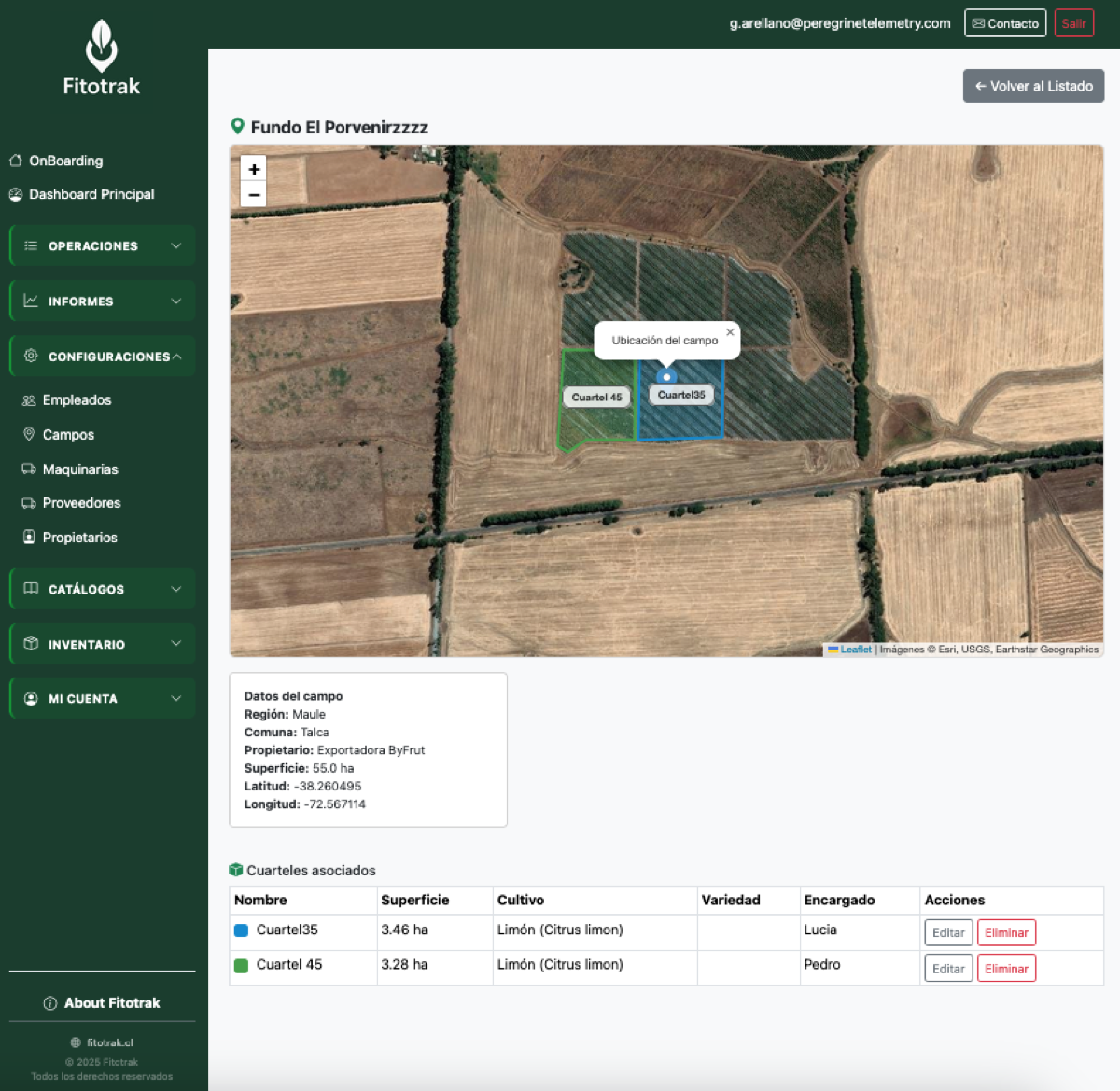
Field overview
Invite your team and control what each member can do
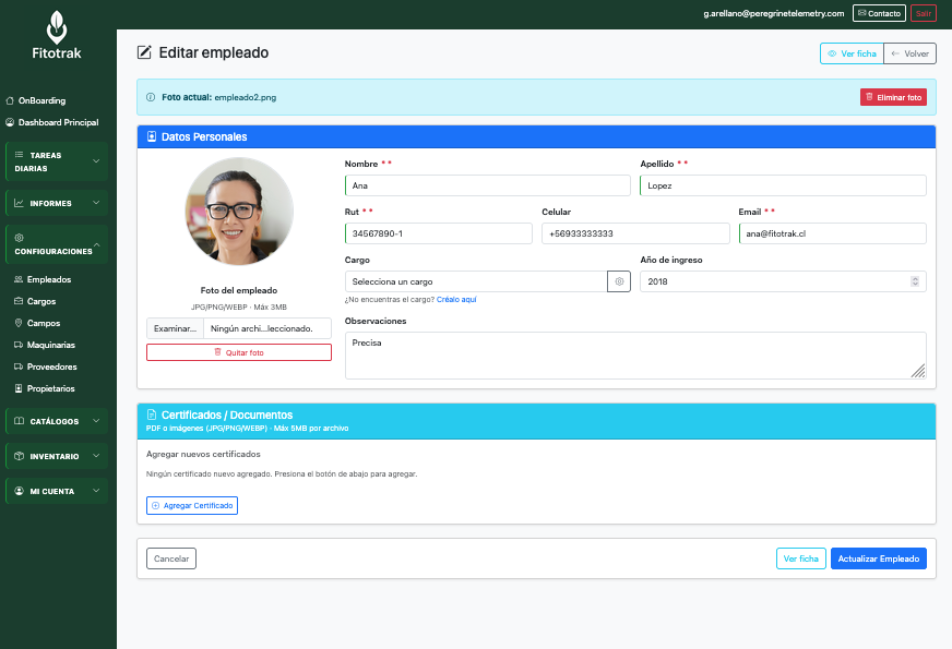
Employee profile
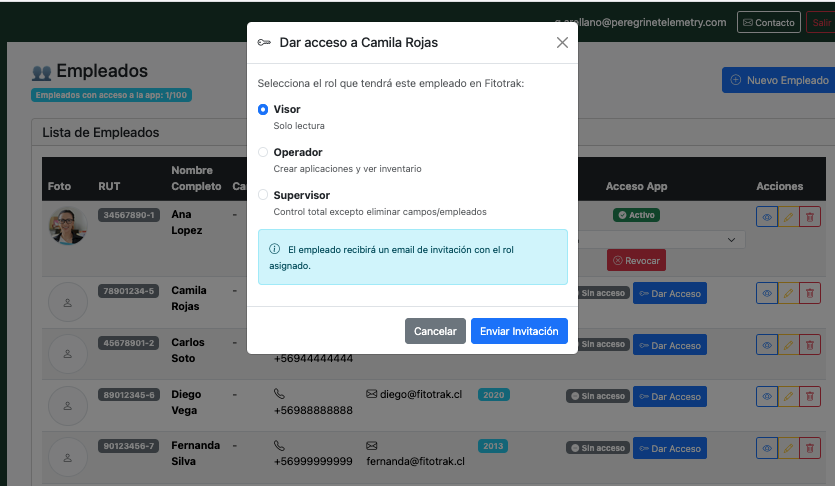
Role-based permissions
Machinery, suppliers, and landowners — available across all modules
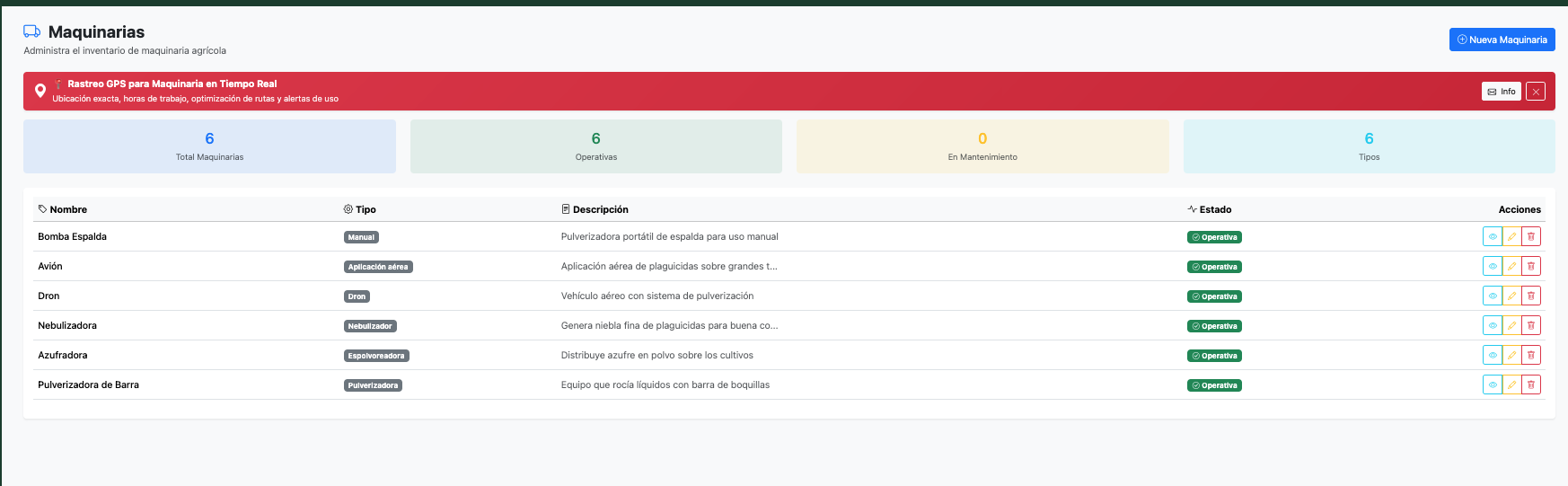
Machinery
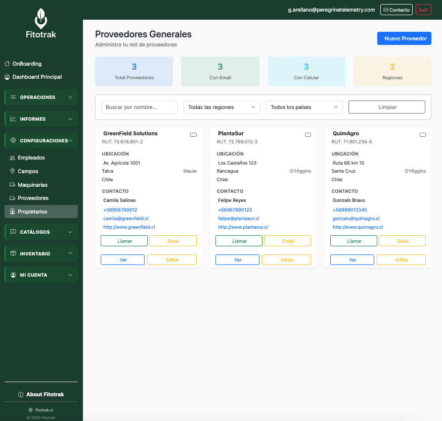
Suppliers
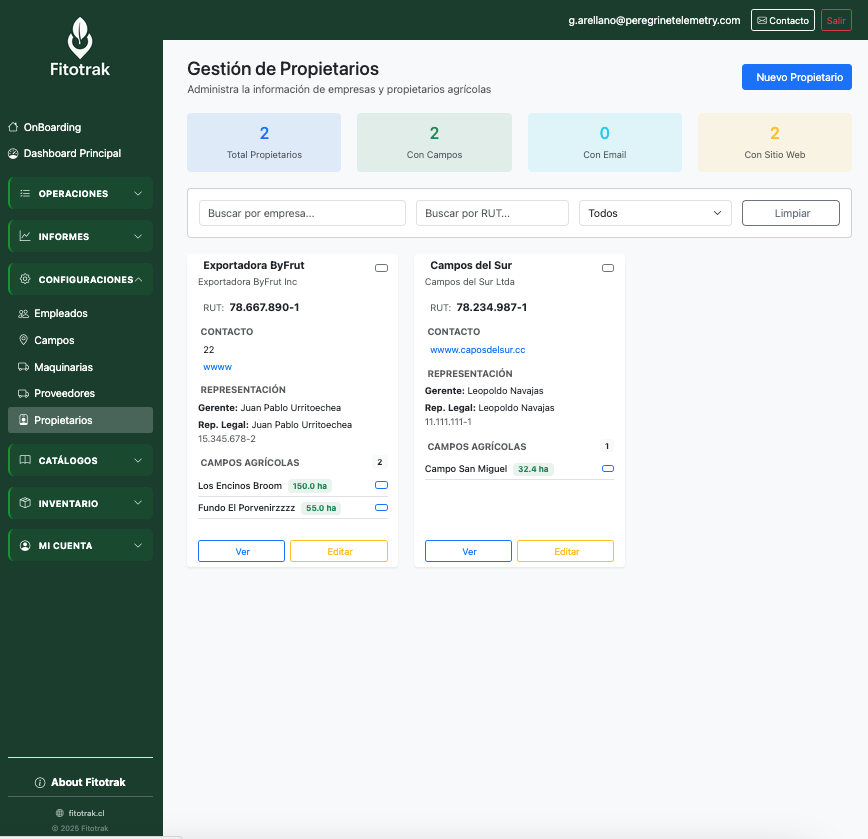
Landowners
Dashboard
Applications
Inventory
Scouting
SAG Catalog
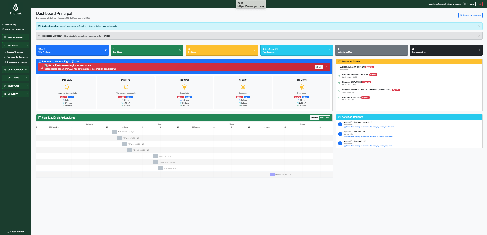
When you log in, you see a complete summary of your operation: acreage, recent applications, weather, and alerts.
Record every application with all the data required by SAG
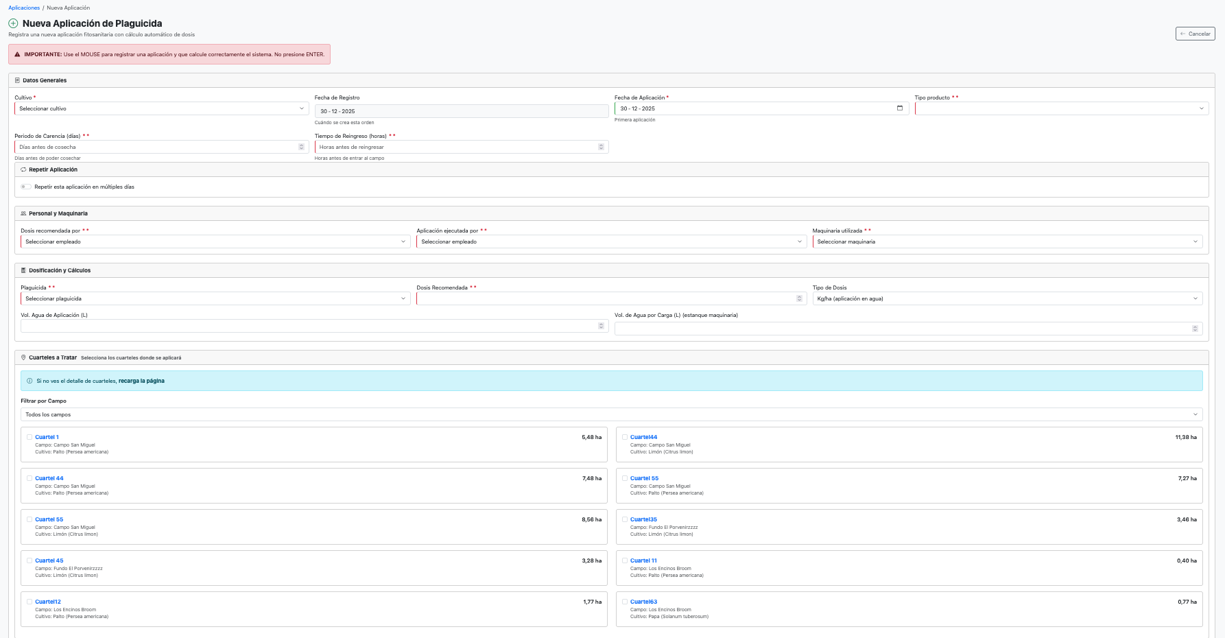
New application
Complete form
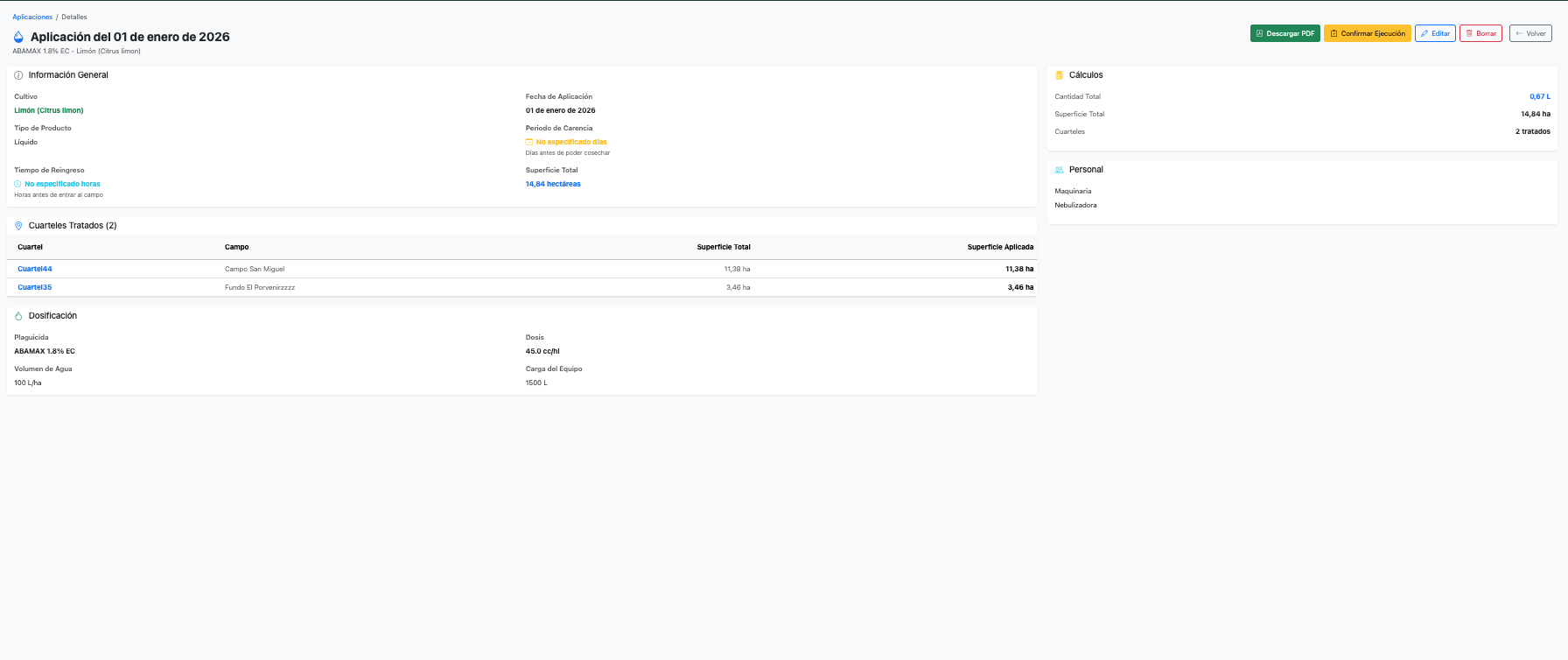
Application detail
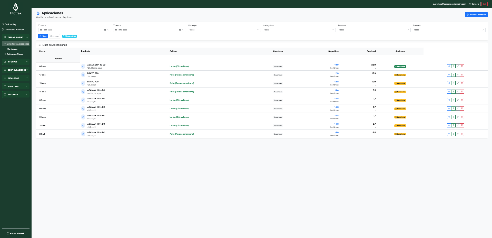
Application list
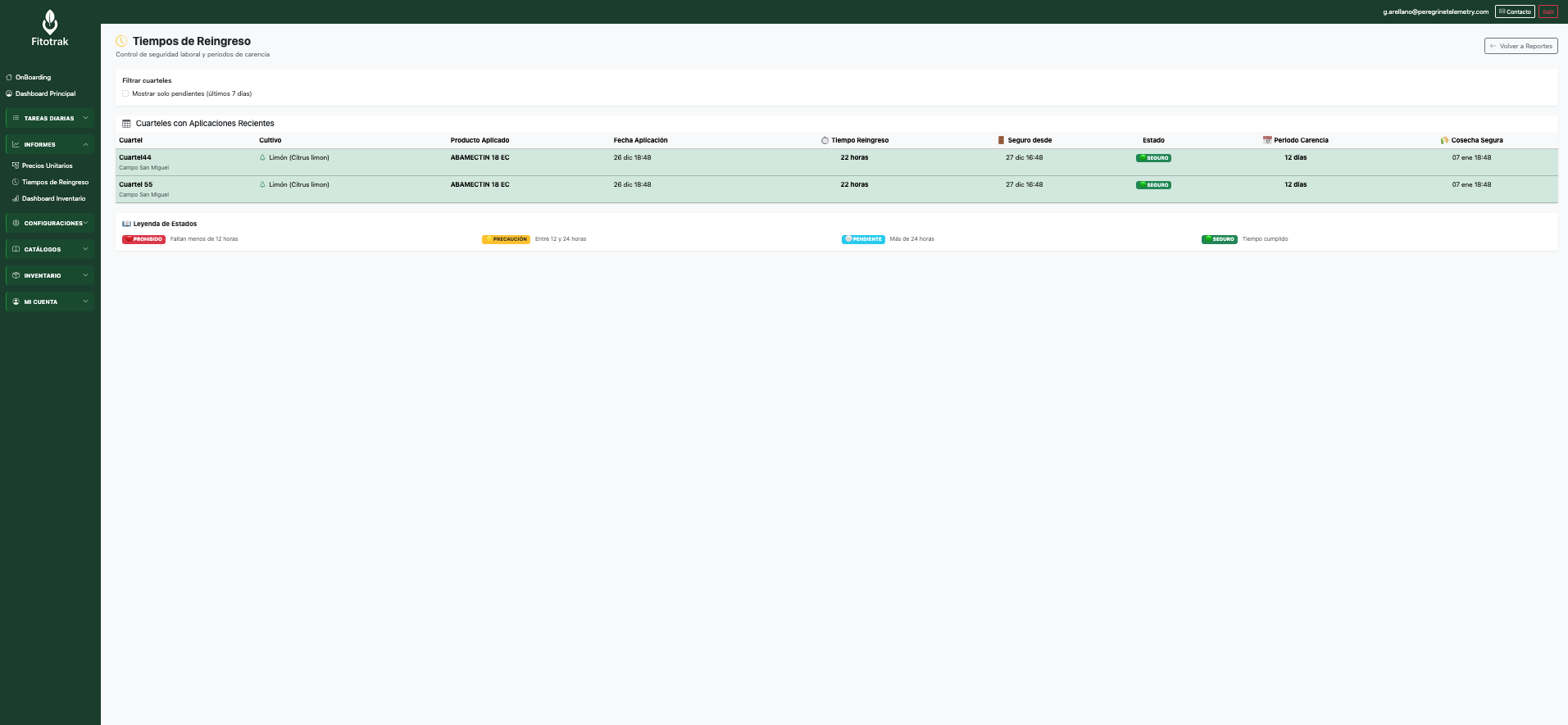
Re-entry interval
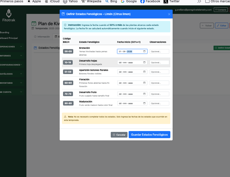
BBCH phenological stages
Automatic stock control with alerts and detailed transaction history
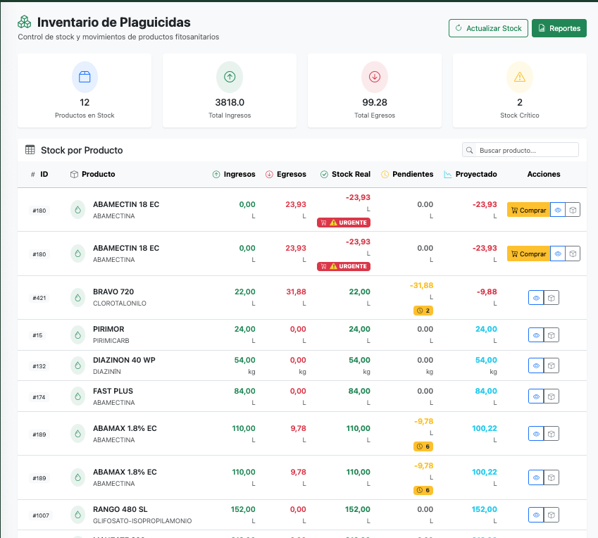
Inventory list
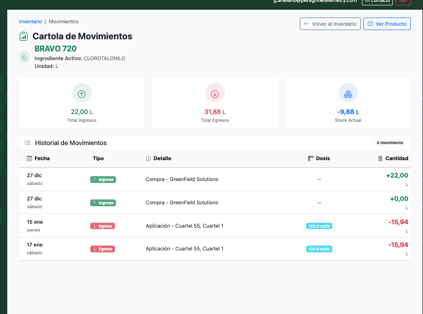
Transaction history
Record observations, pests, and phenological stages in the field
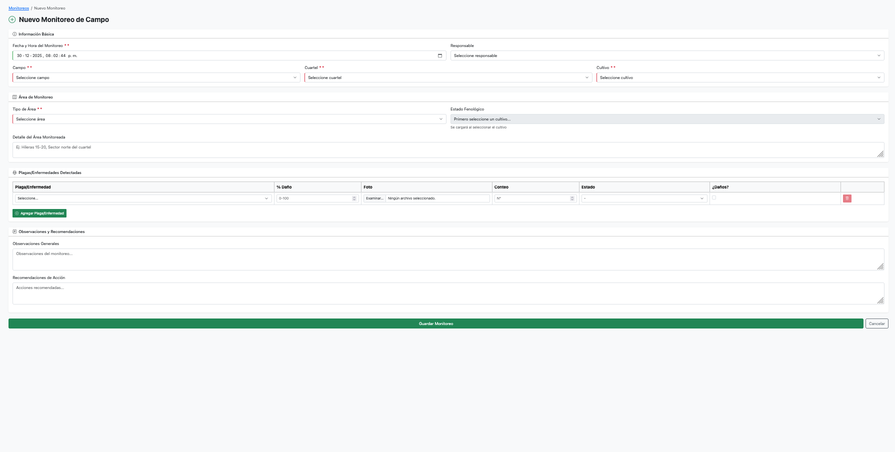
New scouting report
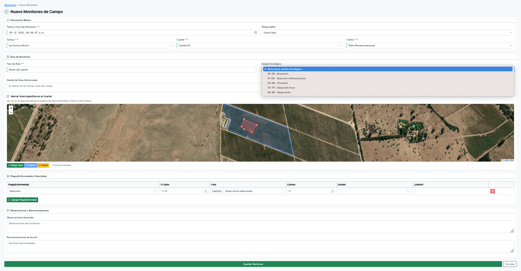
Complete record
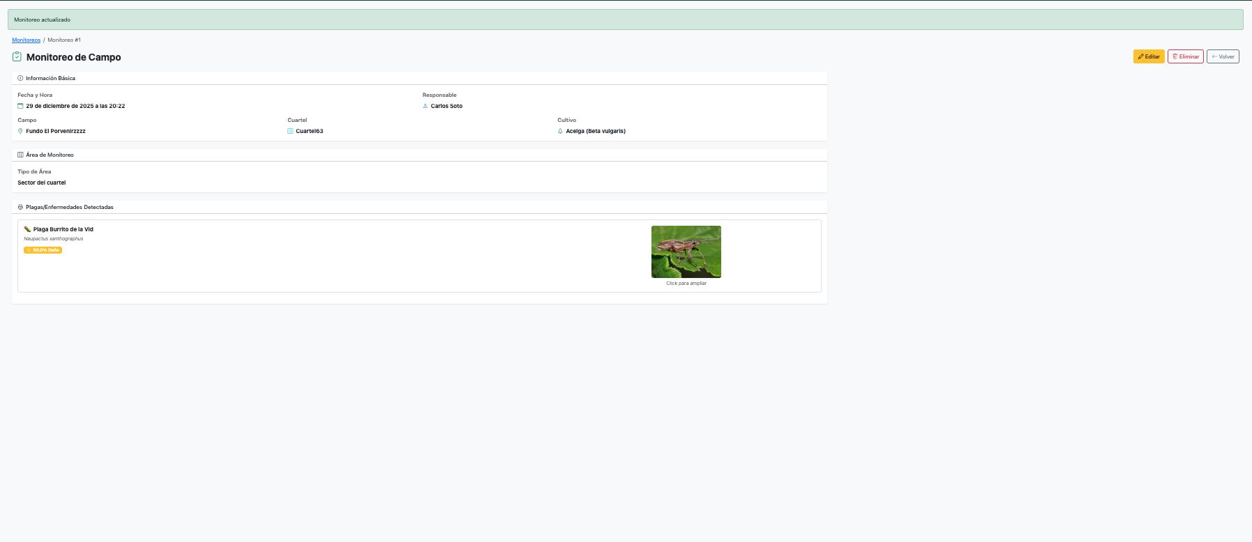
View scouting report
Official SAG database integrated with complete technical data sheets for each product
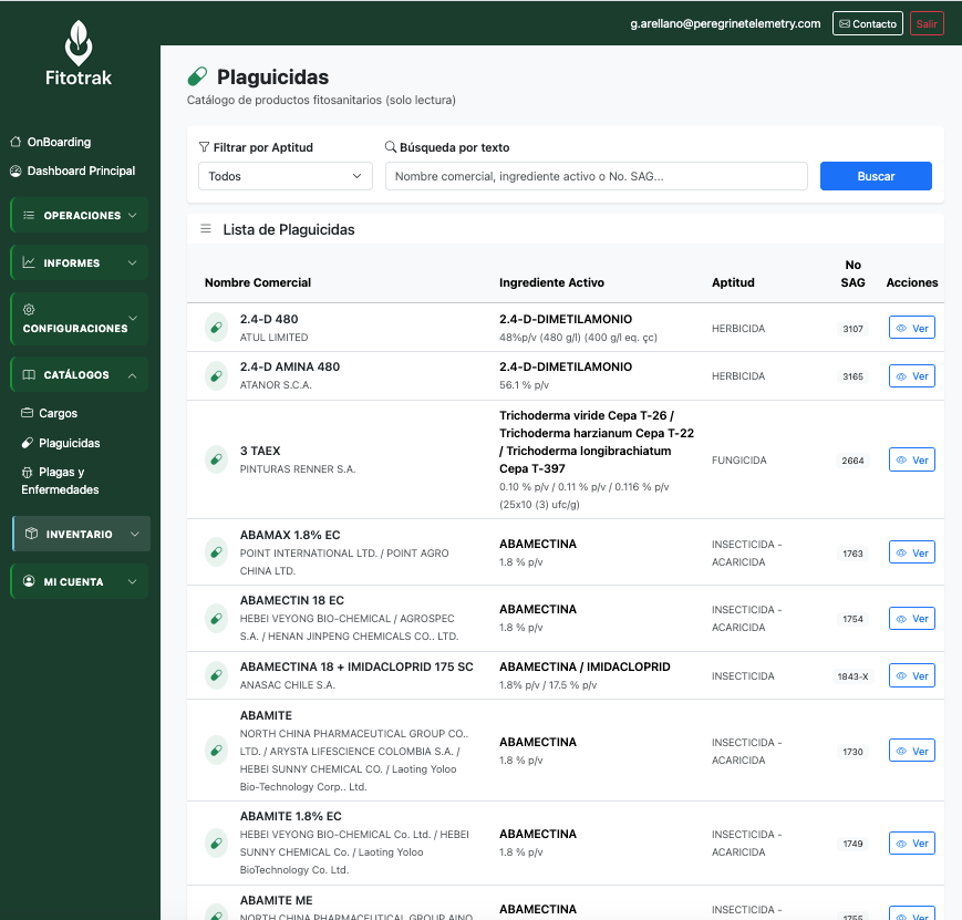
Complete SAG catalog
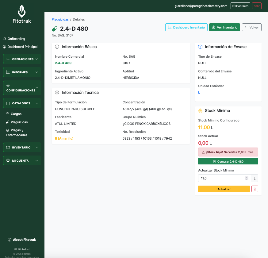
SAG product data sheet
NDVI vegetation index displayed directly on your field map. Detect water stress, pests, or low-vigor zones before it's too late.
NDVI layer over blocks with color scale and real image date
Images updated every 5 days, with automatic cloud filtering and real acquisition date displayed. No additional cost — included in all plans.
Zones
Scheduling
Meteorology
DGA Telemetry
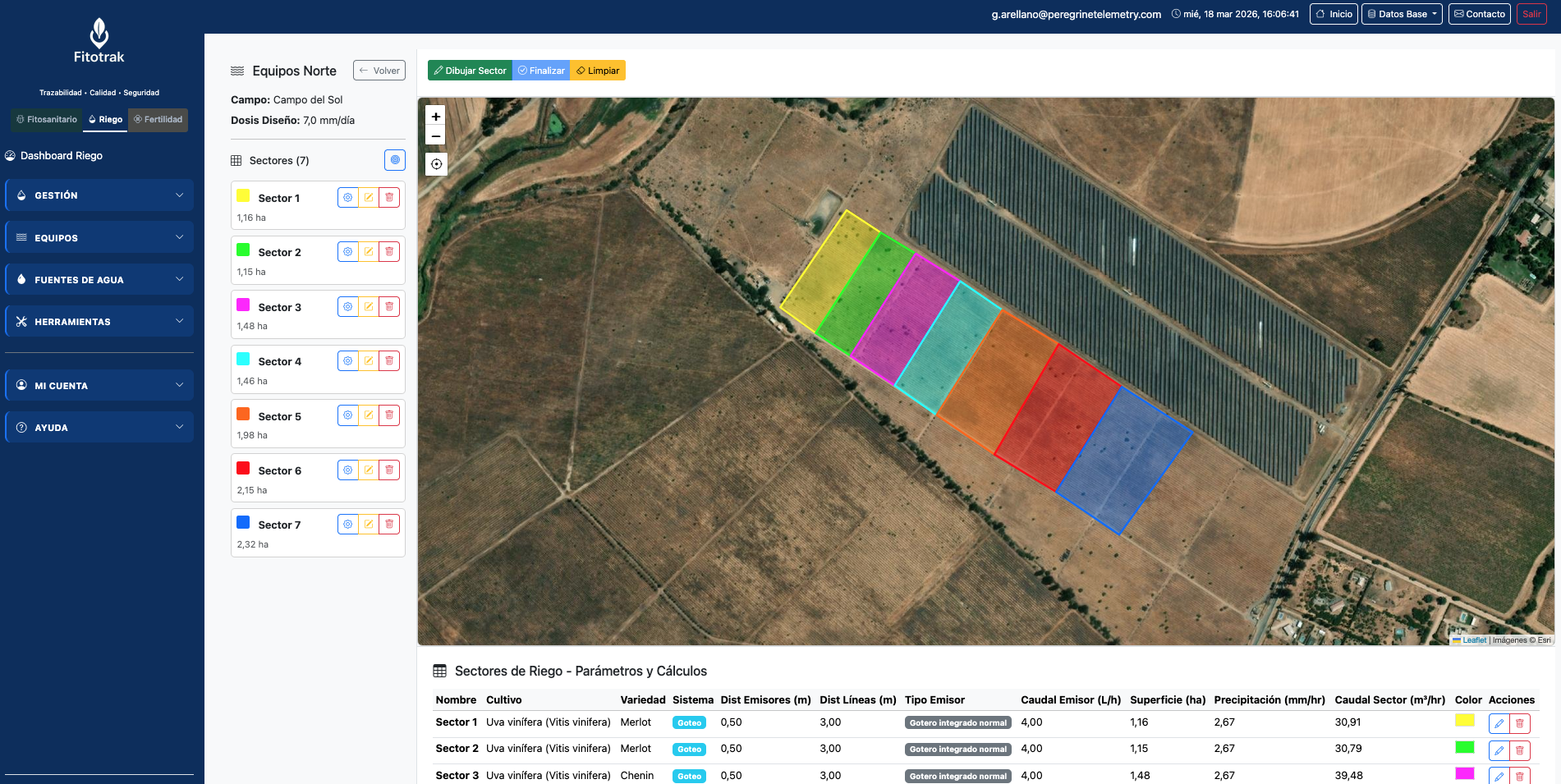
Draw and manage irrigation zones directly on satellite imagery. Each zone has its own design parameters and automatic flow rate calculations.
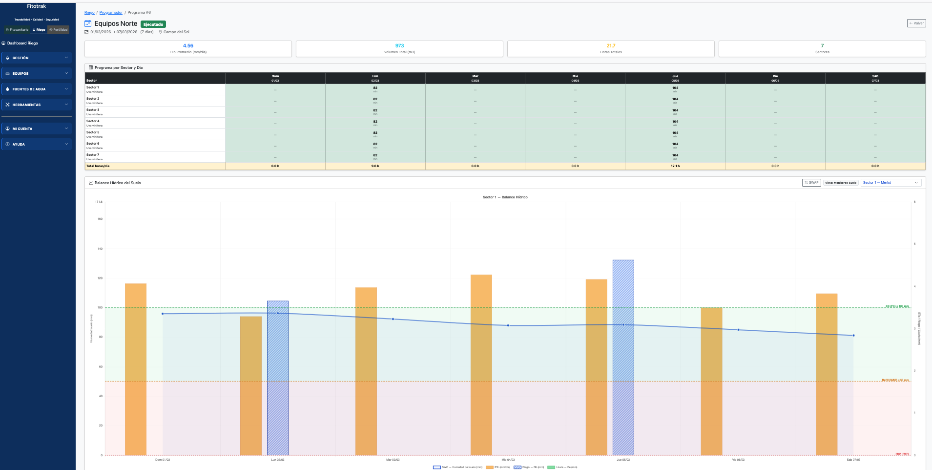
Plan and schedule irrigation turns by zone, integrating weather data and evapotranspiration calculations.
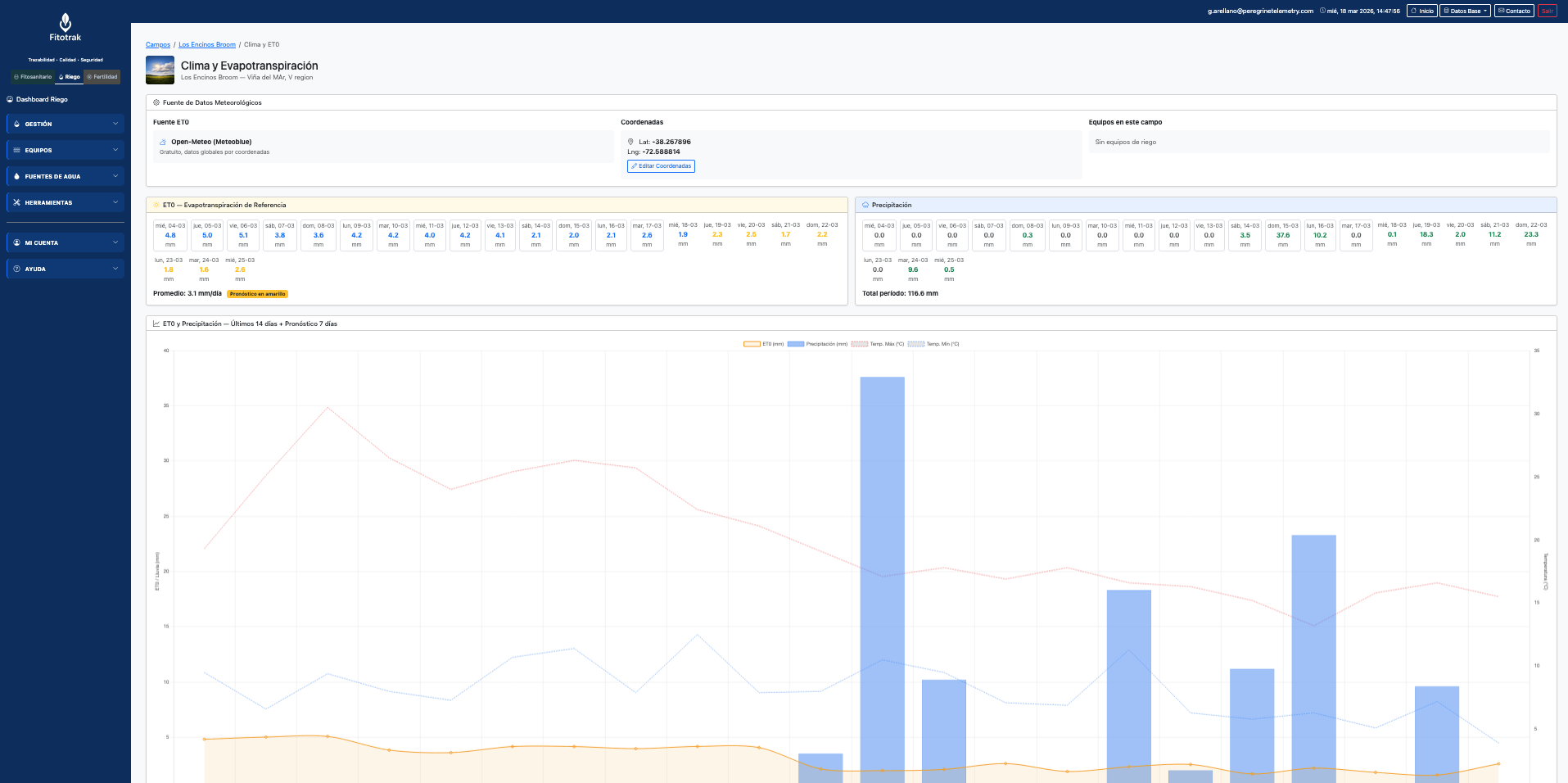
Real-time weather data and automatic reference evapotranspiration (ETo) calculation to optimize irrigation decisions.
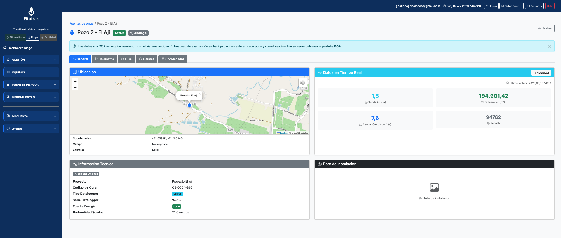
Real-time telemetry with automatic DGA transmission — Decree 53 and RE No. 1238 compliance
DGA transmission is optional and is enabled based on each client's requirements. Without it, the system works fully: real-time visualization, historical storage, reading queries, alarm configuration, and report generation. Transmission is simply an additional layer that is enabled upon request.
Well detail (telemetry)
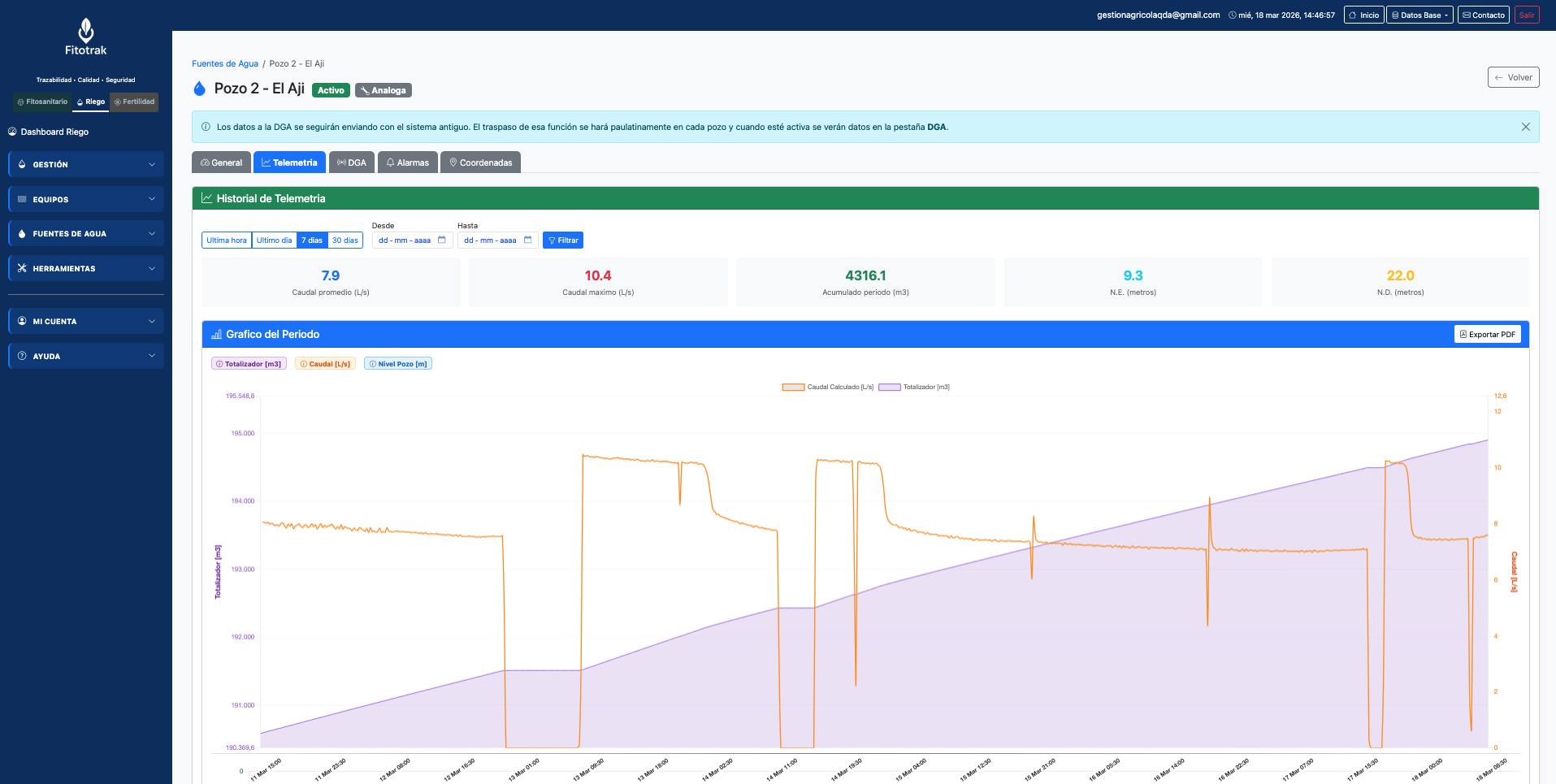
Extraction history
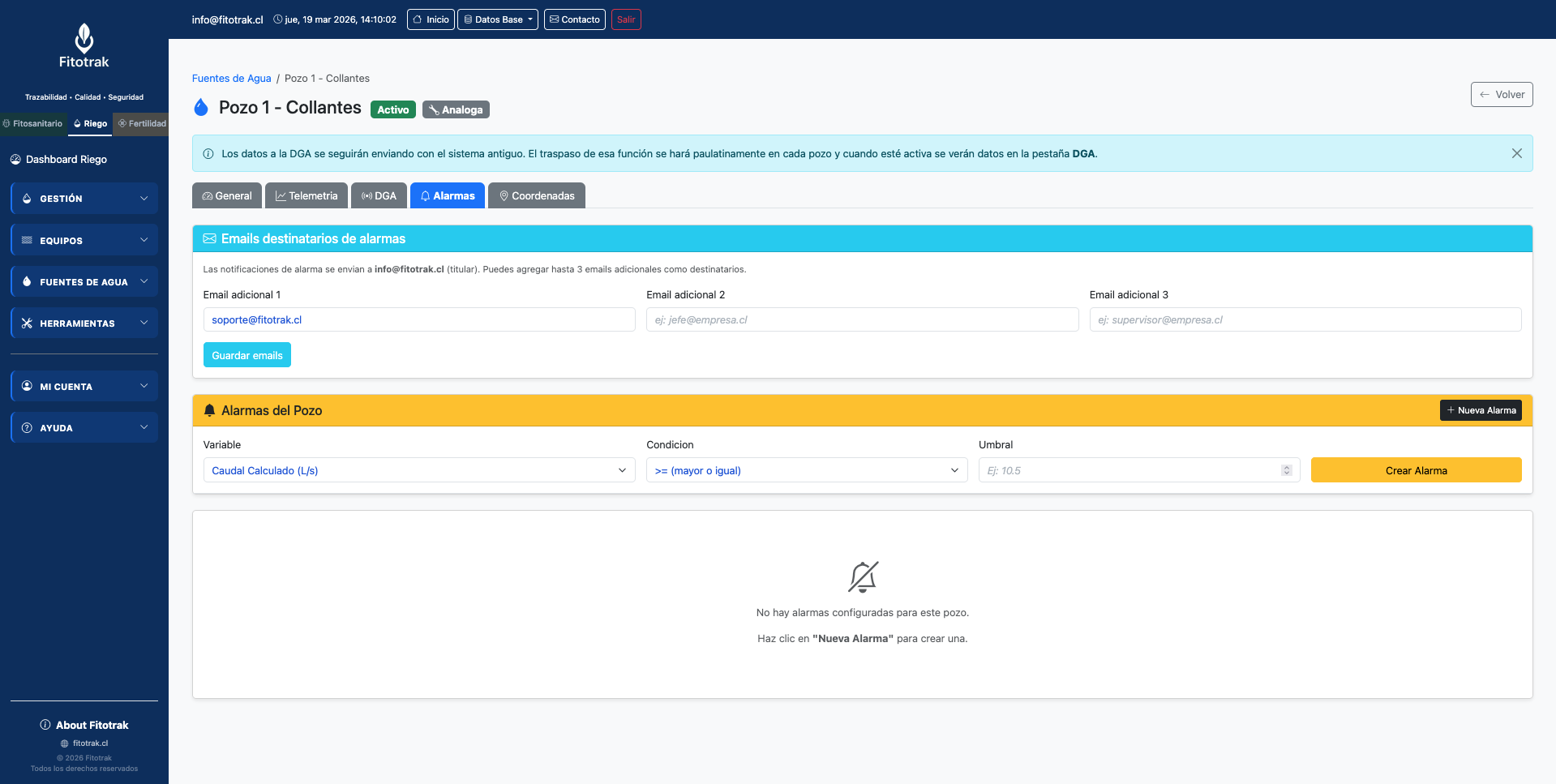
Per-well alarm configuration
Protocols compatible with Exempt Resolution No. 1238. Data is transmitted every 15 minutes with no manual intervention.
View the vegetation status of your blocks and irrigation zones with satellite imagery updated every 5 days.
NDVI layer over blocks with color scale and real image date
Compare vegetation vigor between blocks and across dates to optimize irrigation. Automatic cloud filtering and real acquisition date displayed.
We configure the platform for your company and your client portfolio. Get in touch and we'll tell you how.