New module 2026 · Water management

Water management for
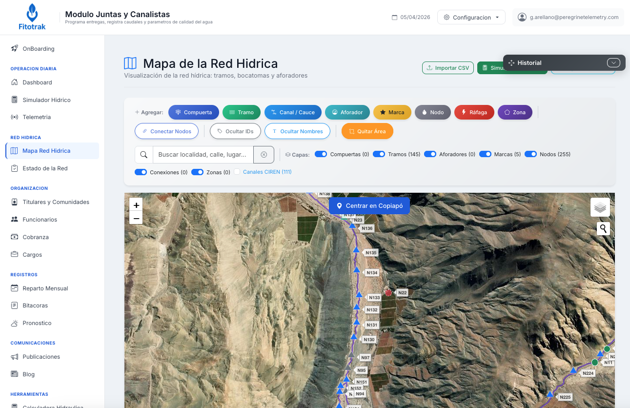
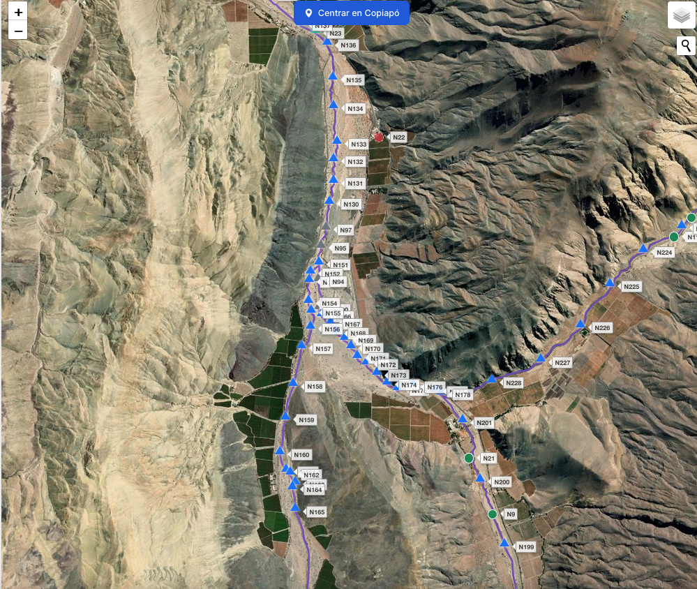
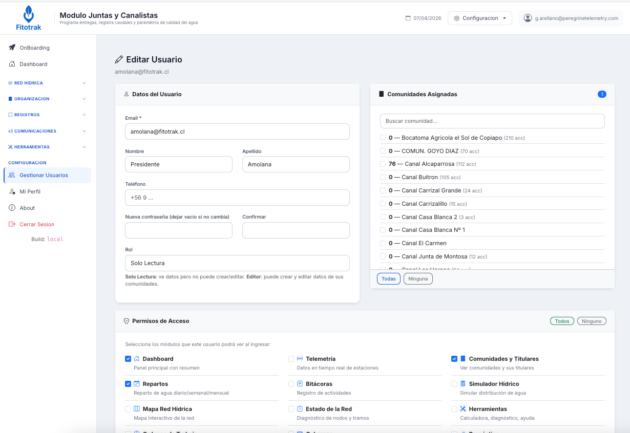
Water User Organizations (WUOs) in Chile

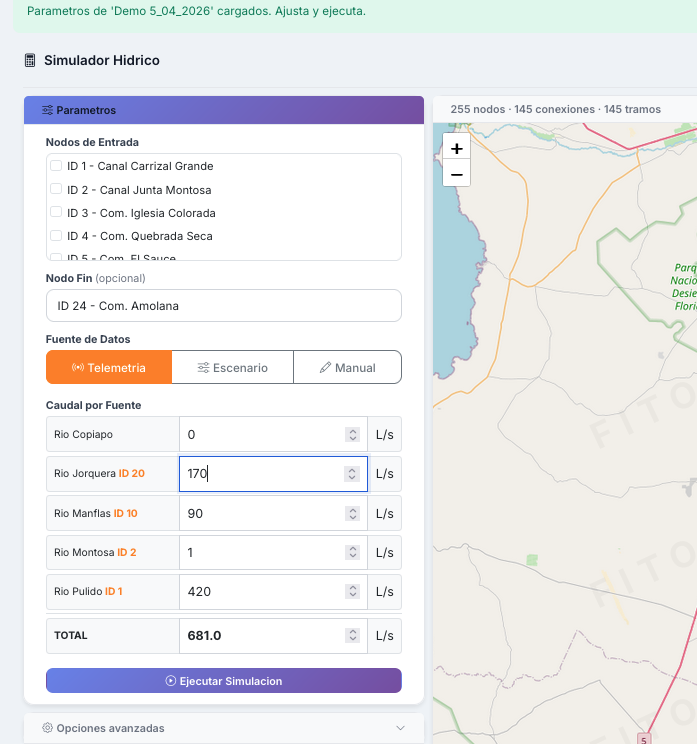
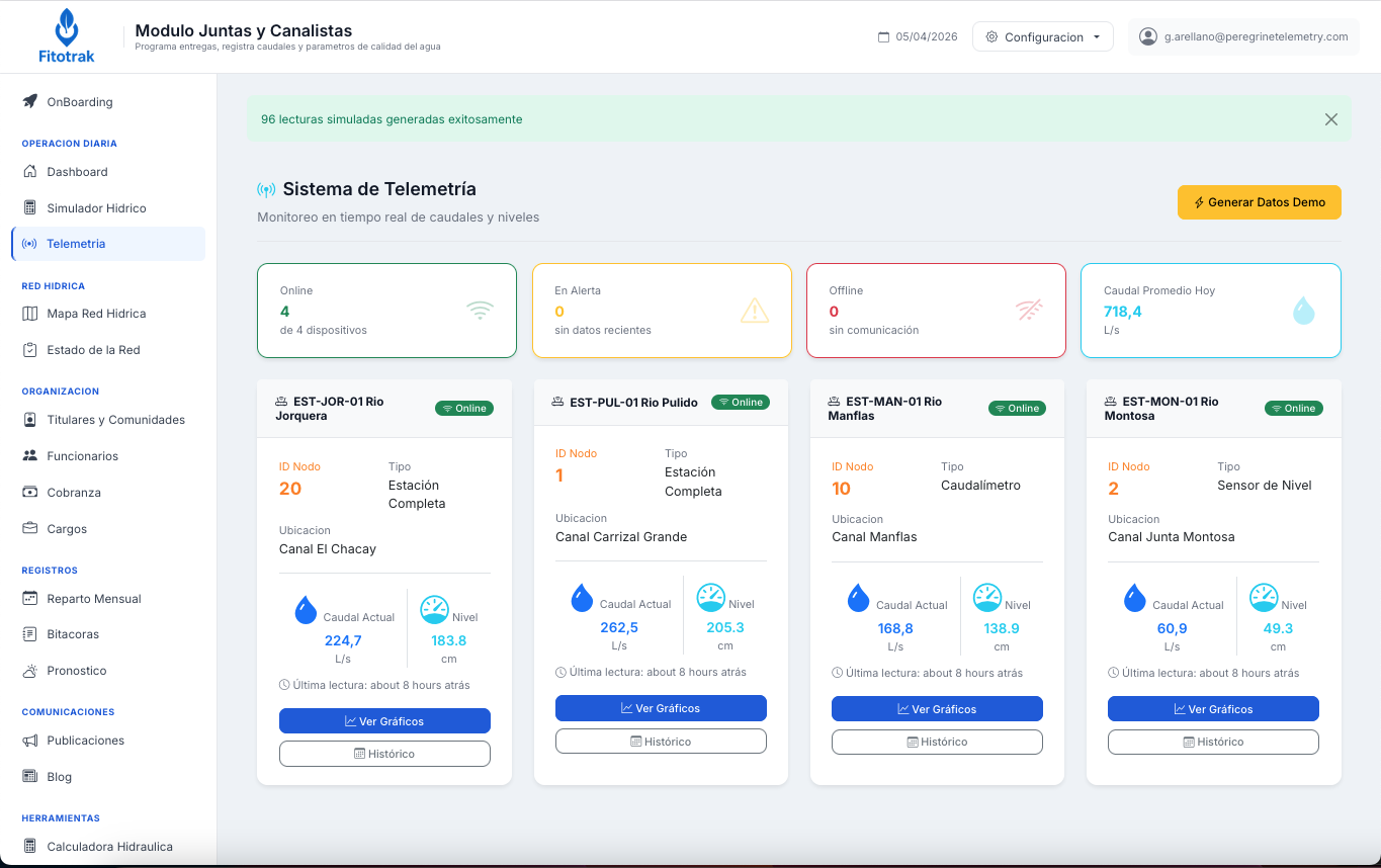
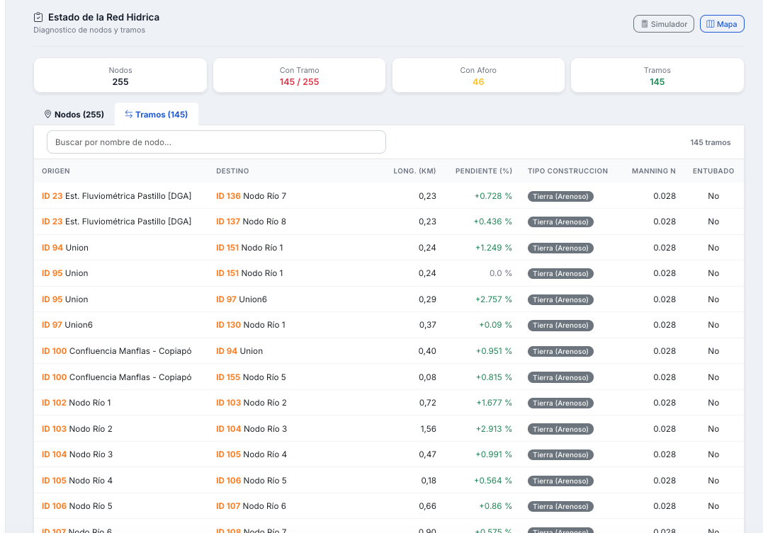
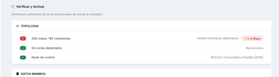
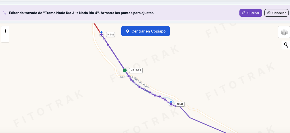
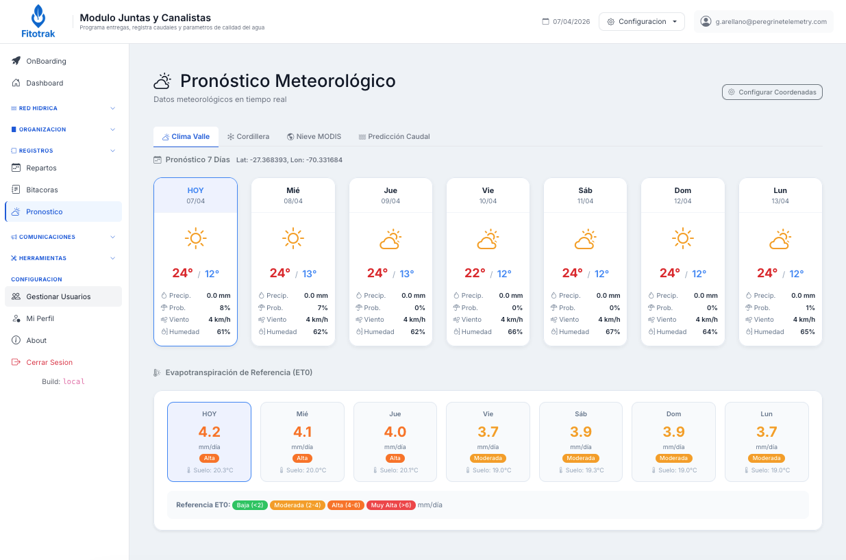
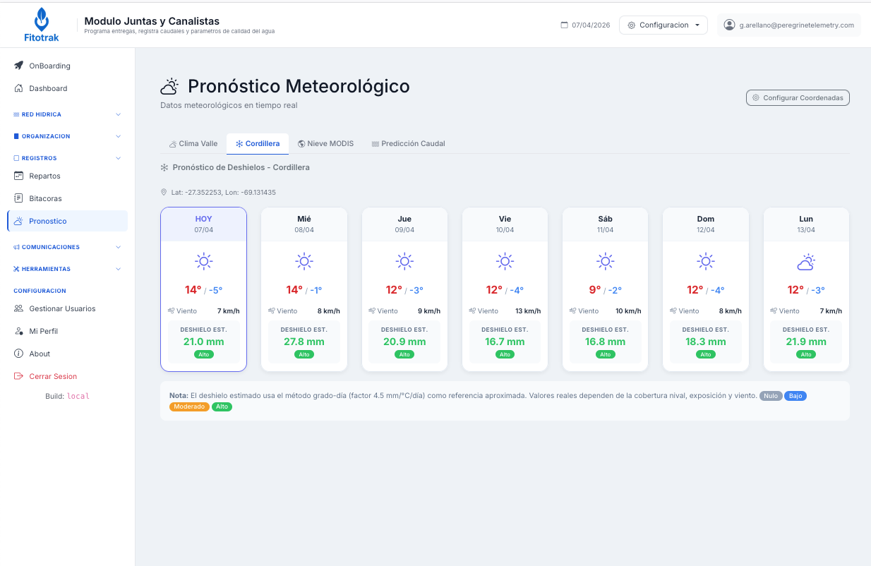
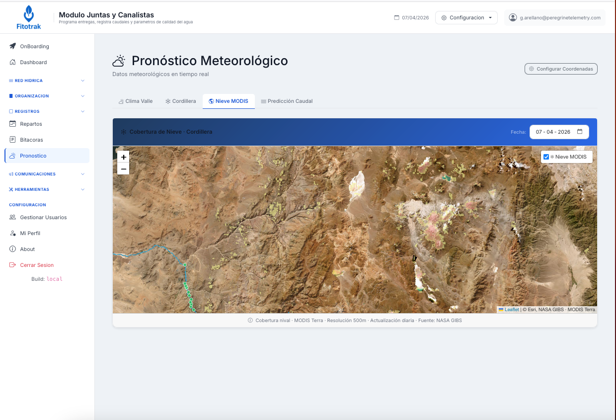
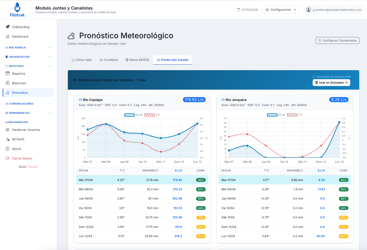
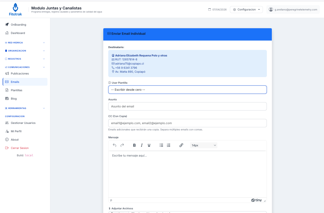
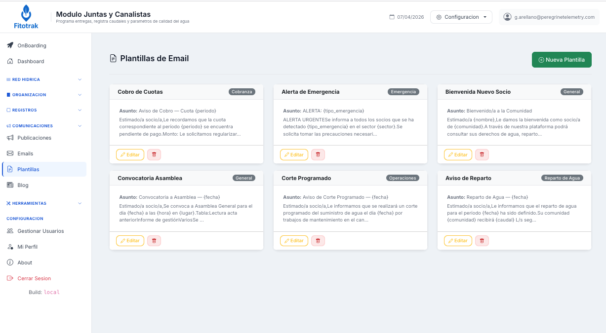
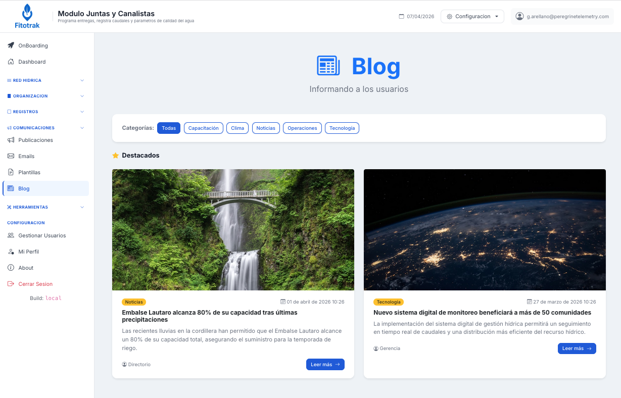
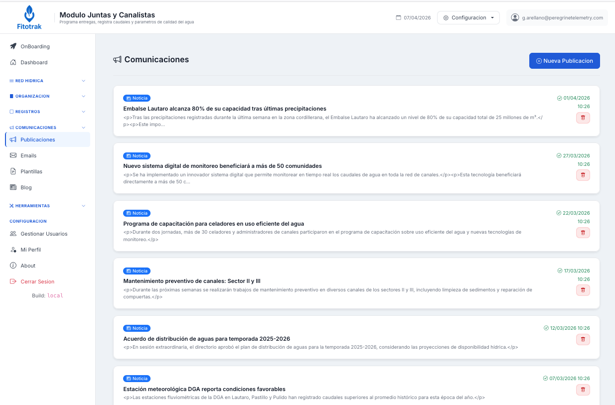
Simulate water distribution, generate allocation reports, and monitor your water network in real time.

Fitotrak Water User Organizations
Our sensors Your sensors Data via API

Why use technology to distribute water?

Distributing water without technology means relying on memory, phone calls, and trust. In a context of growing water scarcity, that is no longer enough. Every poorly distributed liter is a conflict, a cost, and a missed opportunity.

Lack of transparency

Members distrust the allocation when they don't have access to real-time data.

Legal disputes between communities

Without digital records, there is no proof of what was delivered and when.

Unaccounted water losses

Without telemetry, no one knows how much is lost during conveyance.

Allocation based on memory and tradition

Not on actual water rights registered with the national water authority (DGA).

Slow emergency response

Breaks, blockages, or floods are reported by phone or radio, always late.

Inability to audit the history

There is no record of who received what in previous periods.

Dependency on a single person

If the River Inspector is absent, the system collapses.

No early drought warnings

The organization reacts when the river has already dropped, not before.

Members without access to their information

They must call or visit the office to find out their allocation.

juntas_canalistas/mapa
Water Network Map
Available

Your basin, on an interactive map

Visualize waterways, intakes, reaches, and nodes on satellite cartography. Draw and edit the network directly on the map with intuitive tools.


juntas_canalistas/mapa · satelital
Satellite view
Available

The network over real terrain

Toggle between map view and satellite view to verify that each intake and reach matches the actual geography of the waterway.


juntas_canalistas/simulador
Water Simulator
Available

Distribute water before opening the gates

The simulator traverses nodes from intake to intake, calculating Q/water right independently per river and losses per reach. Water balance verified at 100% before simulations.


juntas_canalistas/telemetria
Telemetry
Available

Optional — real-time flow monitoring

Receive flow data from rivers, canals, or specific monitoring points. Data updates automatically and can be preloaded into the simulator.


juntas_canalistas/estado_red
Network Status
Available

Diagnostics before simulating

Verify the hydraulic network topology before running any simulation. Automatically detects orphan nodes, cycles, and missing connections.


Complete platform for daily operations

Designed for the Chilean Water Code. Every feature designed by agricultural engineers and hydrologists.

Daily Operations
  • Hydraulic simulator by reach or full network
  • Q/water right independent per water source
  • Allocation by pro rata, rotation, or guaranteed minimum
  • Deliveries per community based on current rights
  • Pre-simulation variable review
  • PDF allocation report with compliance
  • Record of executed vs. simulated allocations
  • Saved simulation history
Water Network
  • Interactive map with waterways, intakes, and reaches
  • Satellite and OpenTopo views
  • Edit reaches by dragging vertices
  • Automatic snap intake → actual waterway
  • Import from CSV and Shapefile
  • Automatic topological diagnostics
  • Pre-simulation verification
  • Hydraulic config: construction, losses, Manning
Telemetry
  • Real-time flow and level per river
  • Water quality sensors
  • Peregrine, proprietary, or API hardware
  • Status: online / alert / offline
  • History and charts per station
Snowmelt Forecast
  • Degree-Day Method model
  • 7-day flow forecast per river
  • Daily snow cover (NASA)
  • Preload forecasts into the simulator
  • Progressive calibration with real data
Organization
  • Manage communities, holders, and water rights
  • Role-based control: Inspector, Manager, Warden
  • Access portal for representatives
  • Social dues and billing management
Communications
  • Internal blog for members and stakeholders
  • Publish allocation notices
  • Integration with the client's email account
  • Professional weather forecast
Integration
DGA surface water transmission
Data capture via external API
Integrated Fitotrak irrigation module
DGA fluviometric stations
Hardware integration or via API
juntas_canalistas/simulador · verificar
Network Review for Simulation
Available

The network ready to simulate

Before running the simulation, you can check this list. The system also automatically verifies the topology, minimum data requirements, and control nodes.


juntas_canalistas/mapa · editar tramo
Reach Editing
Available

Adjust the waterway by dragging points

Edit the trace of any reach directly on the map using your mouse. Review the km between waterway nodes and intake nodes.


juntas_canalistas/pronostico
Weather Forecast
Available

Snowmelt flow prediction

Degree-Day model connected to high-altitude meteorological data. Predicts the flow of each tributary river for the next 7 days, with MODIS snow cover map.


juntas_canalistas/emails
Sending emails to members
Available

Communicate directly with your members

Send individual or bulk emails to water rights holders. Use pre-designed templates for allocations, billing, emergencies, and meetings.


juntas_canalistas/usuarios
User access control
Available

You decide what each user sees

Create one access per community and control exactly which modules they can see. Dashboard, telemetry, allocations — each permission is toggled with a checkbox.

Implementation

Peregrine implements, you operate

Peregrine Telemetry preconfigures your basin with your organization's real data. Then you and your team continue operating the system independently.

Initial setup by Peregrine

We configure the platform so it's operational from day one:

  • Load intakes, nodes, and waterways from CSV, Shapefile, or GeoJSON
  • Trace the waterway over real satellite imagery
  • Assign intakes to reaches (fishbone pattern)
  • Full hydraulic topology validation
  • Configure water rights per community
  • Calculate slopes and elevations from TOPO
  • Simulation test with real basin data
  • Create users per community with permissions

Then you operate

With the basin configured, your team can:

  • Run allocation simulations with different scenarios
  • Generate PDF allocation reports for each session
  • Add and edit nodes, reaches, and intakes on the map
  • Manage communities, holders, and their water rights
  • Create users for each community with limited access
  • Publish news and announcements on the Blog
  • Monitor telemetry if sensors are installed
  • Record daily, weekly, or monthly allocations
Accepted formats: CSV, Shapefile (.shp), KMZ/KML, GeoJSON. Estimated setup time: 2–5 days depending on basin complexity.
Ready to get started?

Schedule a demo

We use real data from the Copiapó River basin and its tributaries, but we have modified publicly available information since some data may be sensitive.

Contact Peregrine View Fitotrak plans →